Hump Day History
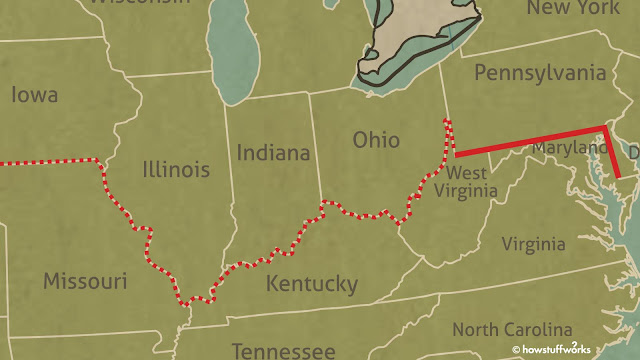
Established on this day in 1767, surveyors Charles Mason and Jeremiah Dixon were hired to settle a proprietary dispute over the Pennsylvania and Maryland colonies.
Mason was the astronomer, following a line of latitude with the stars. They also had Iroquois guides through the wilderness, and a crew of about 120 men.
The Bird Transit has been restored and is on display in Independence Hall.
A zenith sector, telescope, and plumb line mounted on a tripod.
We have more electronic gadgets these days, but the technique is much the same.
Limestone markers were placed at each mile, and crownstones were placed every 5 miles. These were carved with a C on one side, for the Calvert family of the Maryland colony, and P on the other, for the Penn family.
When they reached the Appalachian Mountains, they started using wood posts.
In 1991, a team went out and found all but 10 of the original 132 markers.
In 1820, the Missouri Compromise established the line as the cut between North and South, slavery and freedom. Until 1865.


Comments
Post a Comment