Posts

Showing posts with the label Weather

Science is Fun Fridays!

Image
  You may have seen some images or video of this last week, rare supercilium clouds in Santa Cruz. "Supercilium" means eyebrow in Latin, identifying the arc shapes. They develop in turbulent mountain air rushing downwind. But it's an unofficial classification, not formally listed in the International Cloud Atlas.  It is a more recent proposed supplementary feature of already established altocumulus, stratrocumulus, or cirrocumulus clouds.

Rain Day

Image
(Not My Shot) The last two evenings have brought storm clouds, thunder, and rain. This is mostly good, we definitely need the water, but the flash flooding created some issues. Rain Day started in the late 1800's, when a pharmacist in Waynesburg, PA noted that it always seemed to rain on July 29th.  He started keeping a record, and after he passed, his brother continued.  A local newsman shared the story with other newspapers, and it became tradition to call into Waynesburg to see if it's raining today.  

Storm Chasing

Image
  I have some friends visiting Knoxville and some family on vacation in Florida, so I saw some posts about thunderstorms.  And it's tornado time of year. In the news, I saw there was storm damage across the Ohio and Tennessee valleys, with severe warnings down to the Gulf. There was a show on Discovery called "Storm Chasers" and I didn't always like the teams they focused on, but I liked the footage, and I liked the science. Meteorologist Reed Timmer designed vehicles with anchoring systems to get as close as possible.  Later modifications included compressed-air launchers to send wireless parachute probes to gather and transmit data on tornadoes. Down in Florida, we can see the eaglets dealing with the wind. Apparently one got gusted out, but is on a branch below. I'm seeing tornado watches being issued in North Carolina, Virginia, and Florida. Be safe!

Science for the Holidays

Image
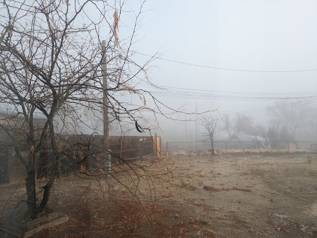
  It is sooo foggy this morning. Since I'll be off on Monday, I thought we'd touch on some science but mostly leave this for an open thread. The water vapor in fog comes from nearby sources, such as a large body of water or a moist ground.  Fog forms when water evaporates from a surface and is added to the air.  As the water vapor rises, it bonds with aerosols called condensation nuclei, (such as dust particles), to form water droplets, which then condense. Fog usually develops when humidity is near 100% and when the air temperature and dew point temperature are less than 4 degrees apart.  At this point, the air is saturated and cannot hold any more water vapor. From AccuWeather: In any case, it does make for a white Christmas! Happy Holidays everyone, enjoy your weekend!!

Science is Fun Fridays!

Image
  The Mendenhall Glacier in Juneau, Alaska. You may have heard the news about the river flooding, which came after what's called a "glacier lake outburst flood."  As glaciers melt and lakes form, sometimes the glacier acts as a dam.   This year, the runoff was especially intense and the so named "Suicide Basin" couldn't hold. This  article  has a time lapse of the basin from a US Geological Survey camera. The glacier had been receding fairly consistently at 160 feet per year, but from August 2021 to August 2022, it retreated more than 800 feet. The ice is also thinning, which means the seasonal and annual cycle of the glacier is losing to the hotter, longer summers.  As it retreats, the whole ecosystem is affected as nutrient levels fluctuate.  Changes in water temperature will have a large impact on species such as salmon.

Science is Fun Fridays!

Image
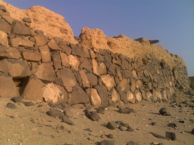
  In the desert of northern Peru is an ancient earthen wall known as the Muralla La Cumbre. It was built near the capital city of Chan Chan, home to the Chimú people, who lived around the 9th-15th century.  In 1470, they were conquered by the Incas. The wall was constructed during the 13th and 14th centuries and spans across 6 miles.  Anthropologists believed it was meant to protect farmlands from invaders, especially since there are accounts of a long-lasting war between the Chimú and Incas in 1400. But new evidence suggests it was built to protect them from devastating floodwaters during El Niño - a climate fluctuation where winds along the equator are weaker, pushing warm water back east along the west coast of the Americas.  This causes the Pacific jet stream to move south and extend, bringing moisture with it. Gabriel Prieto, from the Department of Anthropology at the University of Florida, found layers of sediment on just one side of the wall, and that the lowe...

Science is Fun Fridays!

Image
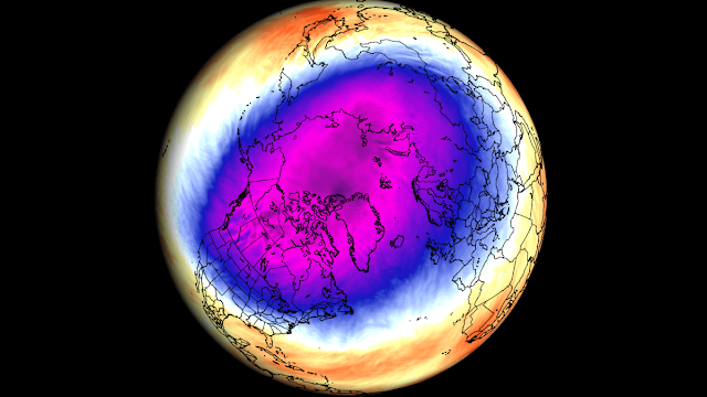
  The polar vortex is a large area of low pressure and cold air which surrounds the North Pole.  It's a known pattern that usually goes unnoticed by those in lower latitudes, but every now and then the air pressure and winds shift. Current temperature map. Typically a large difference in the air drives the polar jet stream, but the Arctic is warming faster than other areas of the planet, which makes the difference less distinct.  This in turn causes the jet stream to meander around the planet more, causing the cold air to wobble, "and, like a toupee that goes askew, it can slip south off of the Arctic..." Scientists are still investigating the connection between the polar vortex and sea ice, but believe it may be dampening the effect of climate change.  As worldwide climate warms, this dip of colder than usual air can keep average temperatures from warming as much as other places on Earth. UCAR

This Day in History

Image
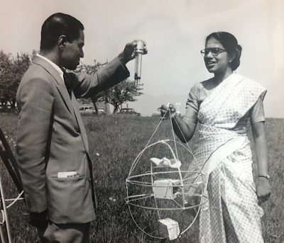
  Today's Google Doodle brings our attention to Anna Mani, Indian physicist and meteorologist. She would have been 104 today. She earned a Bachelor of Science with honors in Physics and Chemistry.  At the age of 22, she received a scholarship from the Indian Institute of Science.  Although she completed five research papers and a dissertation, they wouldn't give her a PhD without a Master's degree, so she obtained another scholarship to attend the Imperial College of London.  There she specialized in meteorological instruments, their calibration and standardization. In 1948, she returned to India and joined the Meteorological Department.  She wanted to make India self-sufficient by designing and manufacturing its own weather instruments.  She constructed rain gauges, hydrographs, thermographs, barographs, barometers, anemographs, etc.  She was most interested in solar energy and set up a network of stations to measure solar radiation.   She r...

Science is Fun Fridays!

Image
Hurricane Dorian has made landfall in North Carolina. On September 4, the Geostationary Lightning Mapper captured this video of the hurricane. NASA's Earth Science Disasters Program has used satellite imagery to create a damage assessment map of the Marsh Harbour area of the Bahamas. This helps officials direct help and assistance where needed, but also helps to understand storm impact. NOAA atmospheric scientist, James Kossin, reports that storms have been moving slower and stalling more over the past 70 years.  The evidence that this is linked to climate change is not as definitive as the evidence that storms are getting stronger and generating more rain due to climate change, but it's something to be aware of. Timothy Hall, a NASA Goddard Institute of of Space Studies scientist, wants people to consider more about a storm than just it's category - the more hazards were prepare for, such as stalling and the angle it hits the coast, the b...