Science is Fun Fridays!
Since sinking in 1912, the Titanic has fascinated us. Multiple expeditions have been to the wreck since it was located in 1985 - 400 nautical miles from the coast of Newfoundland and 12,500 feet underwater - but it's been impossible to see the full picture.
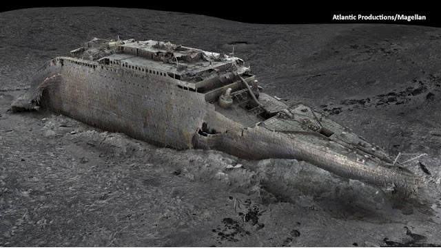
A deep sea mapping company, Magellan Ltd, developed technology that made it possible. The above image is a digital scan of the site, "a highly accurate photorealistic 3D model of the wreck," says specialist Gerhard Seiffert.
Scientists spent six weeks capturing scans, followed by months of processing and rendering the information.
Magellan states this is the largest underwater scanning project in history, generating 16 terabytes of data with more than 715,000 still images and 4k video footage.
Experts in Titanic history consider this an invaluable tool for research, potentially helping to solve some lingering mysteries. For deep sea exploration, it's a "game changer."


Comments
Post a Comment